Pahranagat is located about five miles south of Alamo Nevada, on highway 93, approximately 100 miles north of Las Vegas. The word Pahranagat is a Paiute Indian word that translates in English to mean roughly, "Shining Waters". The lake is natural and has been there a very long time, however, a dam has been built by the Wild Life Department to enhance the lake and make it larger, also to help ensure constancy of water for wild life.
Pahranagat is not so much a hike as it would be a place for a camping outing or a family day trip, you can drive the family sedan right up to the waters edge and park. There are a few hillsides literally strewn with boulders of all sizes and Petroglyphs by the dozens are all over those boulders, even some Pictographs. Some rock scrambling is necessary to see some of the glyphs but many can be seen easily from the lower elevations and trails.
There are many very nice campsites along the shore of the lake, free to the public. The campsites are limited to eight people per site, with no more than two vehicles. There are nearby toilet facilities but no running water, the visitors center is the only source of clean water. Swimming, fishing, and canoeing are all allowed on the lake, as well as kayaking and non motorized inflatable water craft. Most of the campsites are at the waters edge, kayaks and canoes can easily be launched and docked right where you camp.
The following is a collection of pictures of the lake and surrounding Petroglyph rich hillsides. These photos were all taken on a one day outing, in January of 2013, the daytime temperature was near zero on that day with high winds, I hope to return in the warmer months and explore areas we could not access on that day. I personally took many of the photos, but many were provided, with enthusiastic permission, by two fellow hikers in the group I was with on that day, Wade Norton and Yvonne Baur.
Above, The word Pahranagat, translates in English to, "Shining Waters", I think this picture illustrates well, that is a proper name for this lake.
Above, On the day we visited the temperature was in the single digits with wind chill bringing it down even more. These ducks were taking a short break from swimming to warm themselves by standing on the ice.

Above, The shoreline of the lake, Eagles frequently roost in the trees along the shore, ducks and geese as well as cranes and other waterfowl call this home, but also beavers build their homes here.
Above, the white you see at water's edge is not foam, it's ice. Anywhere the waves lapped onto the shore this long bead of ice would form. The small trees out in the water also had ice forming around the branches, as seen both above and in the photo below.
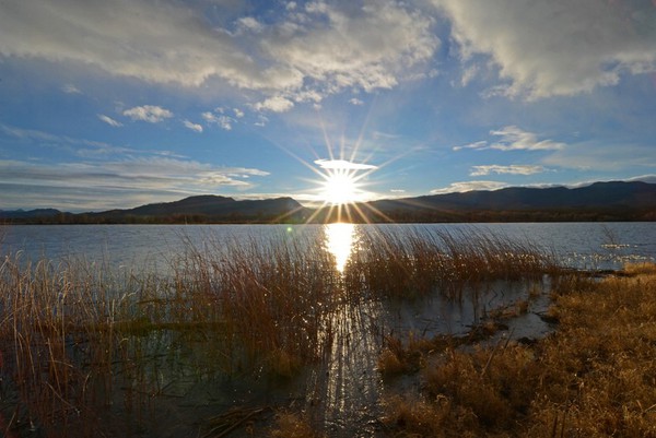
Above, The reflection of the sun on the water seems to instill a sense of complete peace in a person standing on the lake's shore looking across the gleaming water.
Above, These beavers were not just eager beavers, they were over achieving eager beavers. They built quite a large home for themselves here.
Above, This is one of the many campsites along the shore of the lake. Notice the large beach area, ample shade for summer months, and parking right at the site. A kayak or canoe could be launched and/or docked right on the beach.
Above, This lake shore, the eastern edge, is a photographer's dream on a partly cloudy day nearing sunset. We stayed till after dark, catching every glimpse possible of the changing cloud formations as the sun set behind them. Below, The next few pictures are of the glowing sunset
Below, Our visit was in January, very little bird migration going on at that time. We did however, see one flock of white Canadian Geese flying in.
Above, These birds fly so high and unbelievably fast, very difficult to hear them coming toward you, locate them visually, then ready your camera equipment and get a good shot of them. Wade and Yvonne did well to get these few photos.
Above, This old cabin was built in 1870, and is now on Refuge land. It is open to the public and gives one a good idea of what it must have been like in the late 19'th century to have lived in this region.
Above, This is the interior of the old cabin, one room with a fireplace. The floor was dirt.
Above, The view from one of the two windows of the cabin. Those windows probably had some kind of shutters at one time, that could have been closed to keep weather out and warmth in.
Above, Many of the stones used to build the cabin had Petroglyphs in them, remember, in 1870, they were just rocks to the settlers. This face was in one of these stones, I doubt this was done by Indians, more likely by someone that lived in the cabin with a lot of free time on his hands.
Above, Not sure if this was another cabin or a barn. It is near the stone cabin but obviously not as well preserved. I first thought it was a small barn as it had no chimney or fireplace, However, it did have a porch and a corrugated metal roof it may have been some kind of living quarters.
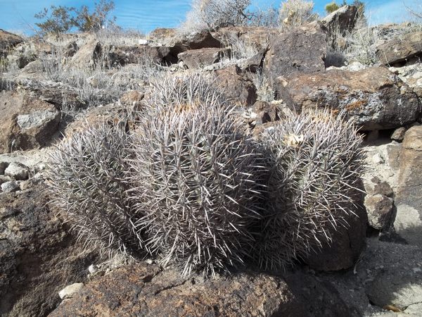
Above, This is a barrel cactus. It is said a person can survive in the desert by cutting into one of these, the moisture stored inside will provide enough liquid to support life. Good to know, but a long, sharp knife would be required, they have some very long, sharp needles.
Above, One of three Pictographs we found on one panel, or rock wall. This one looks a little like a depiction of a cross.
Above, Another of the three Pictographs. This one could be a depiction of the sun.
Above, this is the last of the three Pictographs on the one panel we found. This is more than a depiction of a hand, it is the laft hand of a real person, I'm convinced. I placed my left hand over the print, being very careful not to actually touch, and it matched very closely. I think the person who put this there placed his hand in whatever he used for paint, and then left his hand print on the rock.
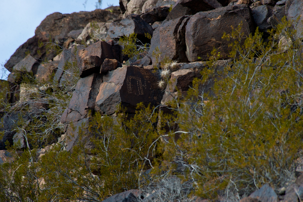
Above, This is one of three images we found of what is called the "Paranagat Man"
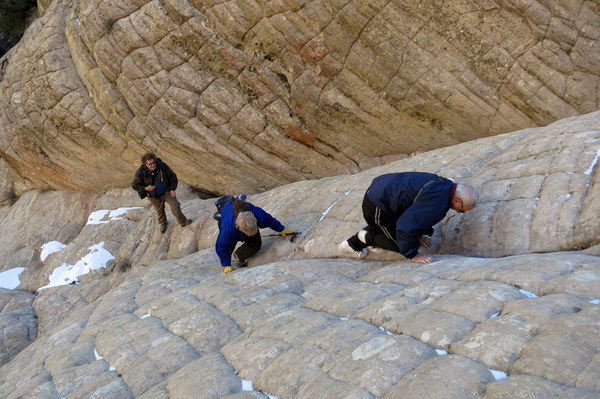
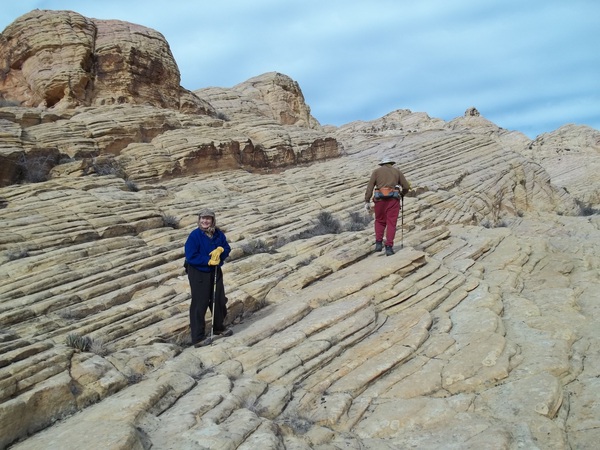
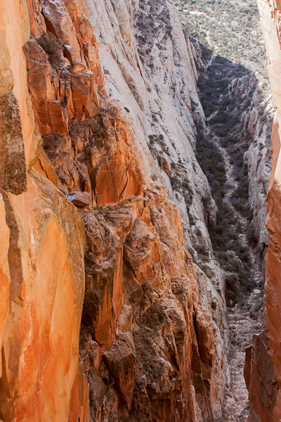
Above, Some rock scrambling and climbing is required to get up to some of these etchings, we didn't do very much of either. There were so many Petroglyphs within easy reach, and time was limited on this outing, we just viewed what we came to easily and saw.
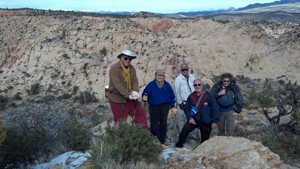
Above, I don't recall what was happening at this particular time,but it appears, Professor Yvonne was giving us all a lecture on this panel of Petroglyphs.
Above, Another image of the "Pahranagat Man". We found only three separate images on this day, the Park Service says there are more than 100 etchings of him in the area.
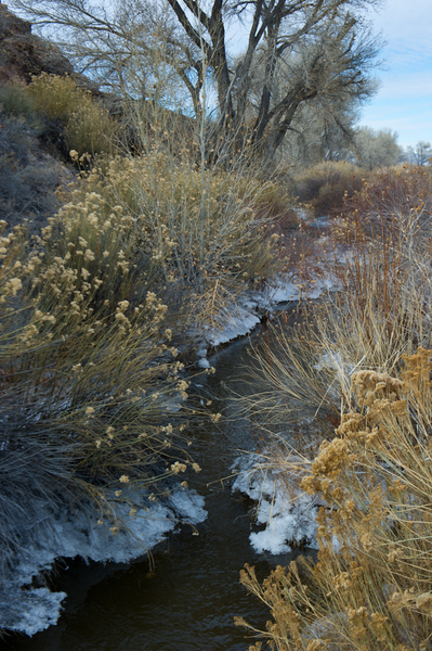
Above, As we traveled by foot from one boulder field to another, we would come across small streams and pools, such as this one. I thought, with the ice and all, very scenic.
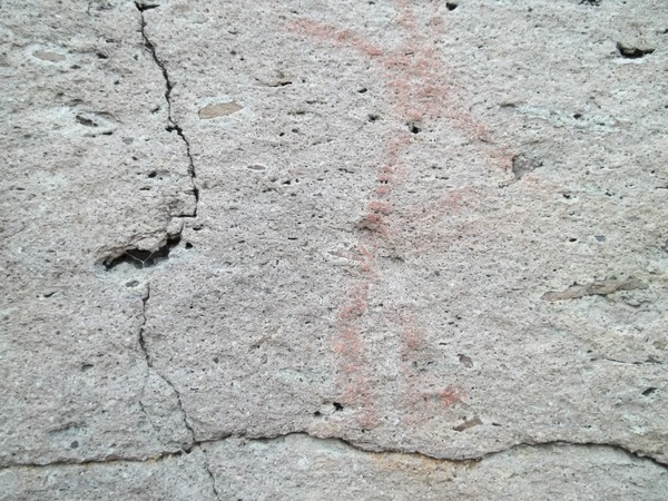
Above, as with most panels, or groupings, of Petroglyphs you find a few that doesn't appear to have any meaning or purpose at all. I suppose only the person who spent his or her time etching this into the rock would know the meaning, or what he wanted to express.
Above, This is an image of what is known as "Blanket Man". We also found a couple of these type images.
Above, We came across a ditch with very little water in it and a layer of ice on the surface. In a few places were these small circles where it appeared warm water was bubbling to the surface, melting the ice in that small space. The area is known to have hot springs.
Above, The third image of Pahranagat Man". The Park Ranger there told us that Pahranagat Man was somewhat of a demonic character to the Indians. Legend says he lived in the lake and would try and lure people, especially children, into the water, then drown them.
Above, This is an image of a hand, there are many hand images all over the southwest, but this is the first I've seen with the arm attached.
Above, The Blanket Man. The Indians believed the Blanket Man provided warmth and security. Unlike the Pahranagat Man, who was hated and feared, the Blanket Man was a character to be sought out, certainly not feared
.

Above, This is the best picture I have of Wade Norton. He and his camera are responsible for many of these photographs, especially many of the sunset shots of the beginning of this post.
Above, These two images appear to be horses. I first thought they were the same big horn sheep depicted all over in the southwest, but these have no horns, only depictions of possibly ears, and brushy tails. The one also seems to have something more, what may have been an attempt by the artist, to draw a rider on horseback. If this is a etching of a horse, that dates the etching to well after 1540, when the first horses were brought here by Spanish explorers.
Above and below, Images I'm sure the artist knew exactly what he wanted to convey, but I, as most people, have no idea what they mean.
Above, Nature provides. Being a senior citizen, I'm used to naps in the afternoon. We;re walking along and wha la, an arm chair. This was inevitably dubbed, "Steve's Flintstone Chair".
Above, This is a very good depiction of Pahranagat Man. Notice how the artist used the natural features of the rock to complete the face, two eyes, a nose, and a mouth. I suspect much thought, vision, and talent went into most of these etchings.
Above, Yvonne Baur. She is also responsible for many of these pictures, she and Wade were both very kind to let me use them.
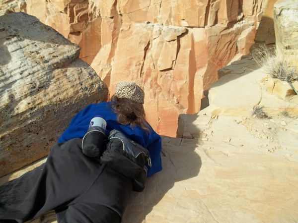
Above, as we walked we had to look closely, I'm sure we walked right by many Petroglyphs but some are hidden well and some just blend into the desert scenery. Look close, you'll see the image.
Above, Some images are almost miniature, again we nearly walked right by many. These two big horn sheep are a good example of small art.
Above, We all enjoyed this outing, I hope to go back in the spring when it will be warmer but before it gets too hot. A person could spend many days out here exploring these rocks and finding unusual glyphs,
Above, We stayed as long as possible, watching as the sun, the clouds, the water, even the shadows, did their little dance. It was as if they were all putting on a special show, just for us, and we didn't want to miss a second of that show. The sun fully set now, we drove out in the dark, very cold and tired from spending the entire day in the elements, but none of us was the least bit disappointed, or felt this was a wasted trip. Our full day was filled with exploration and beautiful scenery and sights. Will go back as soon as the weather warms.